Osmeña Peak
Registration runs about P50 (about US$0.8) to P100 (about US$1.6) per person, a local guide is strongly recommended at roughly P200 (about US$3.2) to P300 (about US$4.8), and the trailhead sits roughly three to four hours by road from Cebu City, so many travelers fold it into a bigger south-coast day.
Short answer
Registration costs about P50 (about US$0.8) to P100 (about US$1.6) per person, a local guide runs roughly P200 (about US$3.2) to P300 (about US$4.8), and the trailhead is reached by southbound bus from the Cebu South Bus Terminal or on a booked day tour from Cebu City.
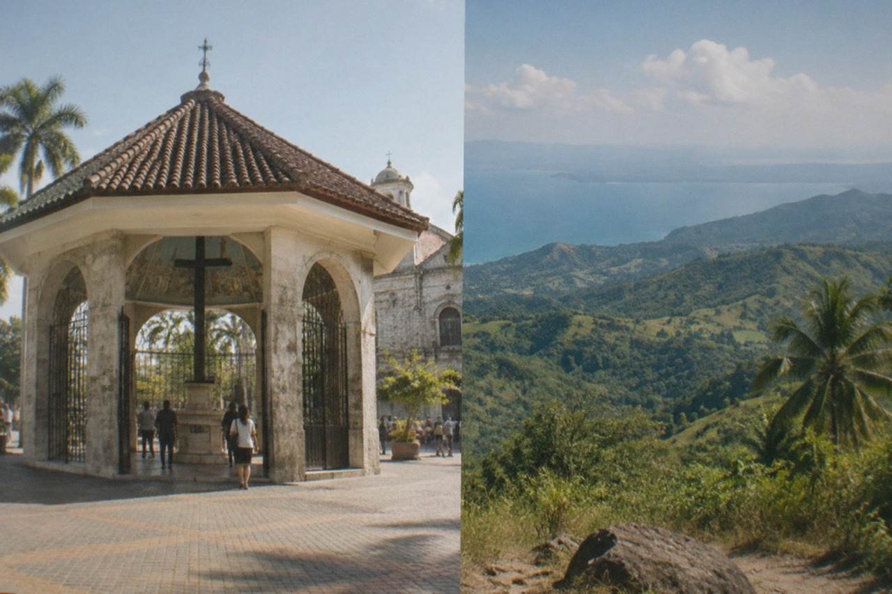
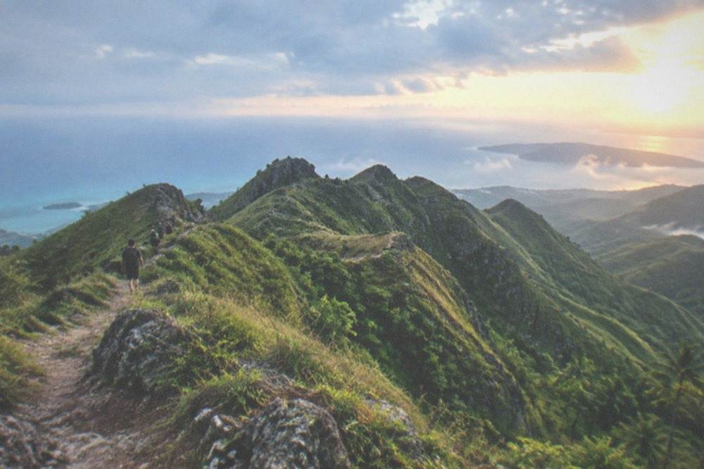
Osmeña Peak sits in the highlands above the coastal town of Dalaguete, on the island of Cebu in the Central Visayas region of the Philippines, and it has become the default highlands stop on almost every south-coast itinerary. The name honours the Osmeña family, whose members held the presidency and shaped the city and province for generations, and the spelling matters: the real name carries a tilde, Osmeña, even though plenty of bus signs and search queries drop it. What draws people up here is not altitude alone but the setting, a ridge of folded green hills that looks nothing like the beaches and dive spots Cebu is usually sold on.
This guide lays out what the verified sources actually say: the registration fee, the guide situation, how the southbound bus network from Cebu City works, what PAGASA's rainfall normals mean for choosing a month, and how the peak pairs with Kawasan Falls and the Moalboal sardine run on a single long day. Where a figure is not published by an official source, it is flagged as approximate rather than dressed up as fact. Fees at rural trailheads in the Philippines change by municipal ordinance, sometimes with little notice, so treat every peso figure here as a planning range and confirm at the desk.
Where Is Osmeña Peak In Cebu And Why Do Hikers Head There?
Osmeña Peak is a highland ridge above the municipality of Dalaguete, on the southeast coast of Cebu Province in the Philippines, reached from Cebu City by the southbound coastal highway. The trailhead sits inland and uphill from the Dalaguete area, registration costs about P50 (about US$0.8) to P100 (about US$1.6) per person, and a local guide at roughly P200 (about US$3.2) to P300 (about US$4.8) is strongly recommended and in practice often required. The hike is the most accessible of Cebu's highland walks, which is why it anchors so many south-coast itineraries.
Dalaguete is a farming and fishing municipality south of Cebu City along the island's east coast, and the peak rises in the hills behind it. The pack of verified facts ties the registration figure to the site at about P50 (about US$0.8) to P100 (about US$1.6) per person, with recent reports landing at either end of that range depending on how the municipality consolidates environmental and guide-related charges. A guide is listed as often mandatory or strongly recommended, at roughly P200 (about US$3.2) to P300 (about US$4.8), and the honest position is that you should budget for one either way: the fee is small, the guides are local, and the income stays in the barangay.
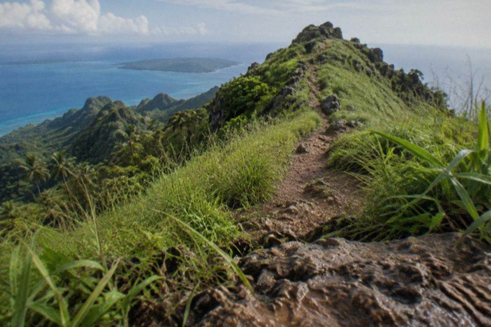
Why hikers head here rather than to some other hill comes down to geography and logistics. The south of Cebu holds the province's most concentrated cluster of marquee sights, from Oslob's whale sharks to the canyoneering route at Kawasan Falls, and Osmeña Peak is the one stop in that cluster that swaps salt water for a ridge view. It also sits inland of the highway corridor that every bus, van and tour vehicle uses between Cebu City and the far south, so the detour is short once you are already moving down the coast. That combination, one hike plus several swims on one road, is the entire reason the peak appears on so many itineraries in the first place.
The name itself deserves a line. Osmeña is one of the great surnames of Philippine political history, attached to Fuente Osmeña Circle in Cebu City and to a long line of senators and presidents, and the peak carries the tilde in any careful piece of writing. Signs may not, search boxes may not, but this site keeps the diacritic because the name actually carries one.
How Much Does It Cost To Visit Osmeña Peak In Cebu?
The direct costs of visiting Osmeña Peak are small: registration runs about P50 (about US$0.8) to P100 (about US$1.6) per person, a local guide is roughly P200 (about US$3.2) to P300 (about US$4.8), and there is no published fee schedule beyond those figures, so budget a few hundred pesos in small bills. The real cost of the day is transport, since the trailhead is hours from Cebu City by road, and a booked tour bundles that drive into one price.
The verified fee range for the peak itself is the registration charge, reported at P50 (about US$0.8) to P100 (about US$1.6) depending on how the municipality consolidates its charges, plus the guide fee of roughly P200 (about US$3.2) to P300 (about US$4.8). No official municipal price list is published online in the verified pack, so those figures come from recent hiker and guide reports rather than a tariff board, and they should be treated as planning ranges, not promises. Bring cash. There is no card reader on a highland trailhead in Dalaguete.
| Cost item | Approximate figure | Notes |
|---|---|---|
| Osmeña Peak registration | P50 (about US$0.8) to P100 (about US$1.6) per person | Recent reports vary by how charges are consolidated; confirm at the desk |
| Local guide | P200 (about US$3.2) to P300 (about US$4.8) | Often required in practice, strongly recommended regardless |
| Kawasan Falls Level 1 entrance (if combined) | about P200 (about US$3.2) per person | Swimming only; canyoneering is separate |
| Kawasan canyoneering with a Badian-accredited guide | roughly P1,500 (about US$24) to P2,000 (about US$32) | Includes guide, fees, gear and lunch per recent reports |
| Tumalog Falls entrance (Oslob side trip) | about P50 (about US$0.8) | Managed locally; confirm on site |
Two cautions on that table. First, the Kawasan canyoneering range is deliberately printed as a range because sources conflict: SunStar reported in October 2025 that tourists typically pay P2,000 (about US$32), while guide sites quote P1,500 (about US$24), and the honest answer is "roughly P1,500 (about US$24) to P2,000 (about US$32) with a Badian-accredited guide". Second, the Alegria canyoneering route is suspended through 2025 and 2026, so only the Badian route runs, and cliff jumping is banned at the main Level 1 basin. Anyone selling you an Alegria descent is selling something that is not currently operating.
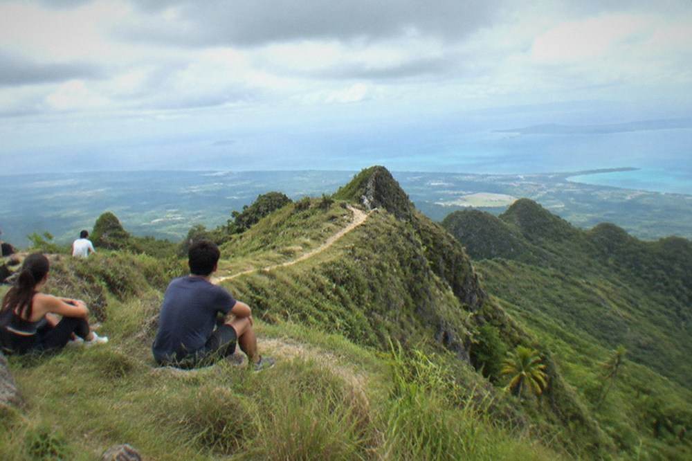
Beyond the trailhead fees, the cost that actually decides your day is the drive. A booked tour prices the whole loop, the early departure, the highway hours, the registration and often a falls stop, into one figure rendered on the live listing, while independent travel trades that fixed price for bus fares and a habal-habal motorbike ride up from the highway. Neither is wrong. The tour buys back roughly half a day of your life; the bus keeps the budget in the hundreds of pesos. For the full picture of what a Cebu trip runs, the things to do in Cebu hub lays out the headline activities in one place.
How Do You Get To Osmeña Peak From Cebu City?
The standard independent route is a southbound bus from the Cebu South Bus Terminal toward the far south coast, then a motorbike or habal-habal ride up from the highway to the trailhead above Dalaguete, with the bus leg alone taking several hours. Booked tours cover the same road from Cebu City with a driver and a fixed departure time, which is why visitors choose them for a peak-plus-falls day. No official fare for the Dalaguete leg is published, so confirm at the terminal.
The verified transport facts cover the southbound network from the Cebu South Bus Terminal. Ceres Liner runs multiple buses daily along the south coast: the Bato via Oslob route takes about 3.5 to 4.5 hours with more than nine departures a day, and the Moalboal route takes about 2.5 to 3.5 hours with a bus roughly every 30 to 45 minutes. Dalaguete sits on the same southbound corridor, but the pack does not publish a Dalaguete-specific fare or journey time, so this guide will not invent one; ask at the terminal window and expect something in the same order as the other southbound fares.
| Southbound route from Cebu South Bus Terminal | Approximate journey time | Approximate fare | Frequency |
|---|---|---|---|
| Cebu City to Oslob (Bato via Oslob) | about 3.5 to 4.5 hours | about P145 (about US$2.3) to P250 (about US$4.0) | 9+ daily, roughly 03:00 to 19:00 |
| Cebu City to Moalboal | about 2.5 to 3.5 hours | about P120 (about US$1.9) to P210 (about US$3.3) | roughly every 30 to 45 minutes |
From the highway, the last leg up to the trailhead is normally a habal-habal, the Philippine motorbike taxi, and the verified pack gives a useful benchmark from the Oslob side of the south coast: the habal-habal rate from Tan-awan to Tumalog Falls runs P50 (about US$0.8) to P100 (about US$1.6) each way. The Dalaguete uphill rate is not published, so treat that Oslob figure as a sense of scale rather than a quote, and agree the price before you get on. Pay onboard the bus or at the terminal window; the Ceres network takes payment either way.
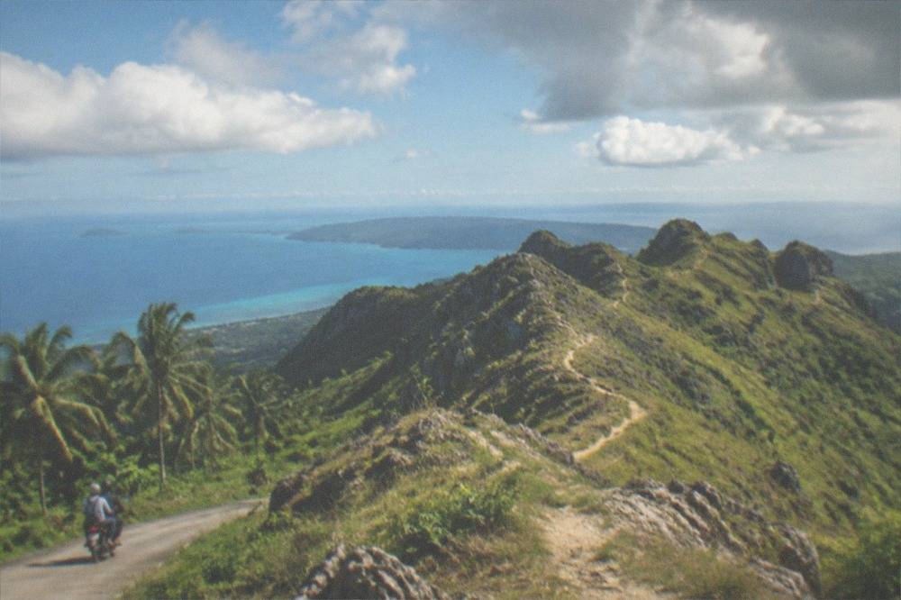
This is the point in the planning where most people weigh the bus against a booked day, and the honest arithmetic favours the tour for a peak-plus-falls combination. The road hours are long, the registration and guide arrangements are local knowledge, and a tour from Cebu City puts all of it behind one driver and one departure time. The listings below render live prices and ratings from verified product data, so the figures come from the operators rather than from this page.
If you would rather move under your own steam, the same corridor works fine: an early bus south, a motorbike up, the hike, a motorbike down, and a second bus onward to Moalboal or back to Cebu City. The one thing the independent plan cannot fix is the clock. Buses thin out in the late afternoon, and the last thing you want is to be negotiating a habal-habal fare in the hills at dusk with the day's final departures already gone.
When Is The Best Time Of Year To Hike Osmeña Peak In Cebu?
The best months for Osmeña Peak are the dry season, December to May, with March and April the driest of all at 58.6 mm and 48.1 mm of rain respectively at PAGASA's Mactan station, while June to November is the rainy season and October is the wettest month at 194.8 mm. Cebu sits in the typhoon belt from June to November, so a dry-season visit buys clearer skies and a far lower chance of a washed-out day.
The rainfall table below is PAGASA's own monthly data from the Mactan station, the 1991 to 2020 climatological normals, and it is the single most useful planning tool on this page. The pattern is classic tropical: a dry stretch from December through May, with April the driest month at 48.1 mm, and a wet run from June through November that peaks in October at 194.8 mm. The annual total is 1,685.0 mm spread over about 138 rain days, which tells you something the monthly averages hide: even in the dry season, short afternoon showers happen, they just do not linger.
| Month | Rainfall at PAGASA Mactan station (mm) | What it means for the hike |
|---|---|---|
| January | 105.2 | Dry season; cool mornings, Sinulog crowds in Cebu City |
| February | 69.6 | Dry season; one of the better months |
| March | 58.6 | Dry season; hot and clear |
| April | 48.1 | Driest month of the year |
| May | 95.0 | Dry season's end; heat and building humidity |
| June | 175.6 | Rainy season begins |
| July | 192.9 | Wet; typhoon season under way |
| August | 143.5 | Wet, slightly drier than July on average |
| September | 179.6 | Wet; typhoon peak approaches |
| October | 194.8 | Wettest month; worst choice for the ridge |
| November | 161.9 | Wet; storm risk lingers into the "ber" months |
| December | 139.7 | Transition; dry season re-establishes itself |
Two seasonal notes deserve more weight than they usually get. First, the typhoon season runs June to November with peak activity roughly July to October, and PAGASA flags high landfall risk for the Visayas in November and December; Typhoon Tino in early November 2025 brought record rainfall and severe flooding to Cebu, a reminder that a "shoulder month" is not a safe month. Second, the 30 September 2025 magnitude 6.9 earthquake off northern Cebu damaged heritage churches in the north of the island, but the south, including the Dalaguete highlands, sits far from that epicentre and no damage was reported at the peak or at the south-coast attractions. The Department of Tourism confirmed in late October 2025 that Cebu remained open to visitors after both events.
Within any given day, the dry-season pattern argues for an early start, and not only for the light. The southbound road is long, the midday heat on an exposed ridge is the hard part of the walk, and the afternoon is when those short sharp showers arrive even in March. Every booked tour on this corridor departs early for exactly that reason.
Can You Combine Osmeña Peak With Kawasan Falls Or Moalboal In One Day?
Yes, and that is exactly how the pairing is done: Osmeña Peak pairs naturally with Kawasan Falls in Badian or with the Moalboal sardine run, because all three sit along the same southbound corridor from Cebu City, and booked combo tours exist precisely for this day. The peak's registration and guide fees are tiny compared with the driving, so the constraint is hours in the day, not money, and a small-group or private tour is the realistic way to fit two stops before dark.
The geography does the work here. Dalaguete, Badian and Moalboal all sit on Cebu's southwest-facing flank, close enough that a tour van can run the peak in the morning, drop down to Kawasan for the falls in the early afternoon, and still have the group back in Cebu City by evening. The verified fee stack for that combo day is modest: about P200 (about US$3.2) for the falls' Level 1 entrance, roughly P1,500 (about US$24) to P2,000 (about US$32) if you add Badian-accredited canyoneering, and P100 (about US$1.6) for the Moalboal environmental user fee that covers swimming and snorkelling at the sardine run under the local 2021 ordinance.
| South Cebu stop | Approximate entry cost | What you get |
|---|---|---|
| Osmeña Peak | P50 (about US$0.8) to P100 (about US$1.6) registration, P200 (about US$3.2) to P300 (about US$4.8) guide | Ridge hike above Dalaguete |
| Kawasan Falls Level 1 | about P200 (about US$3.2) | Swimming at the main basin; cliff jumping banned |
| Kawasan canyoneering (Badian route) | roughly P1,500 (about US$24) to P2,000 (about US$32) | Guide, fees, gear, lunch; Alegria route suspended |
| Moalboal sardine run | P100 (about US$1.6) environmental user fee | Shore snorkelling at Panagsama; sardines are resident year-round |
| Pescador Island dives | about P100 (about US$1.6) per dive | Marine sanctuary fee, collected through dive shops |
The Moalboal sardine run deserves its own sentence of praise because it is the least effort-dependent spectacle on the island: the municipal site confirms the school is resident, accessible from shore at Panagsama, and best in the early morning. Pairing a ridge hike with a shore snorkel is a strange and wonderful day, one that no single-beach destination can offer. If you are weighing a full Moalboal day trip against a split day, the split works only with a tour; independently, the bus schedules push you toward one base town per day.
For the falls half of the combo, the half-day canyoneering product from Moalboal below is the strongest-rated option on the roster, and the falls-plus-peak combo tour from Cebu City is the one that built this itinerary in the first place.
One honest caution about doubling up: canyoneering is a physical half-day in its own right, and stacking it behind a morning ridge hike is a big day for anyone not reasonably fit. The swimming-only Level 1 visit at P200 (about US$3.2) is the right downgrade if the legs are complaining, and the falls stay open to walk-ins even while the phased rehabilitation program continues.
What Should You Pack For A Day Hike In The Cebu Highlands?
Pack for a hot, exposed, occasionally slippery tropical walk rather than an alpine one: one to two litres of water, sun protection, shoes with grip, a light rain shell even in the dry season, and cash in small peso bills for the registration desk, the guide and the motorbike up. The Mactan climate normals put the mean temperature at 28.1 C with a mean maximum of 31.3 C, so heat, not cold, is the variable that ends most visits early.
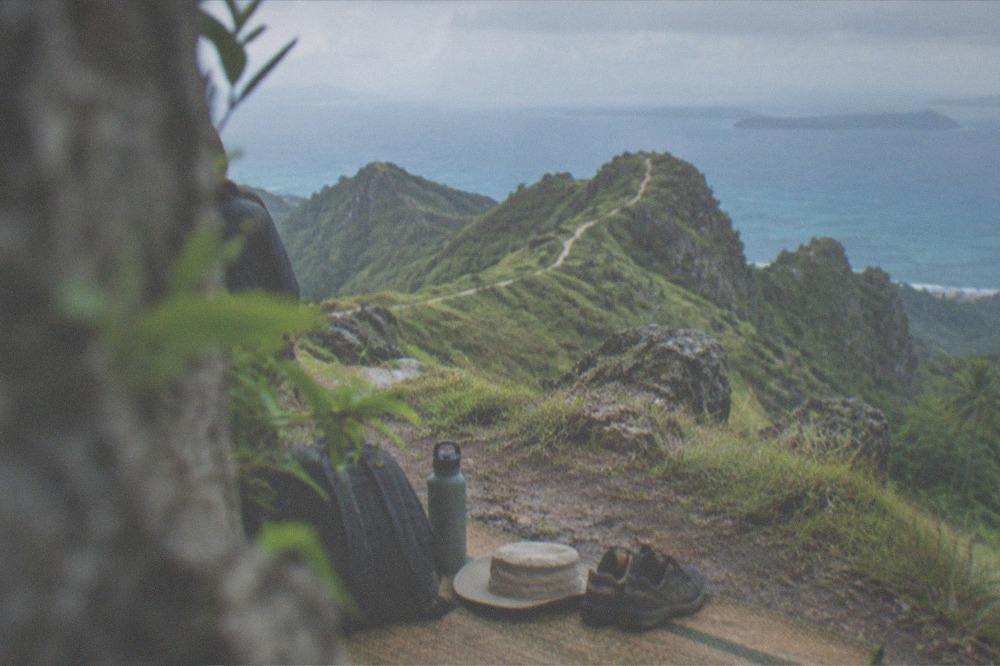
The climate data in the verified pack gives the honest baseline: a mean of 28.1 C, a mean maximum of 31.3 C and a mean minimum of 24.9 C at the Mactan station, with 1,685.0 mm of rain over about 138 rain days across the year. Highland Dalaguete runs a touch cooler than the coast at dawn, but the ridge itself is grass and rock with little shade, and the midday sun is the real obstacle. Water is the item people under-bring.
| Item | Why it earns its place |
|---|---|
| One to two litres of water | No reliable kiosk at the trailhead; heat is the main risk |
| Sun hat and sunscreen | The ridge is exposed grass with almost no shade |
| Shoes with grip | The path is dirt and grass, slick after any rain |
| Light rain shell | Even April averages 48.1 mm of rain at the coast |
| Small peso bills | Registration, guide and habal-habal are all cash |
| Snacks | Food options thin out in the highland barangays |
Electricity and connectivity are the two practical questions that follow. The Philippines runs on 230 V at 60 Hz with plug types A, B and C, so most US and EU travellers need an adapter for any recharge at a stopover, and a power bank is the better answer for the trail itself. Signal in the highlands is patchy rather than absent, which matters if you are coordinating a pickup at the trailhead rather than riding down with the same habal-habal driver who brought you up.
Is Osmeña Peak Suitable For Beginners And Families?
Osmeña Peak is one of the most beginner-friendly highlands walks in the Philippines provided three conditions hold: you start early to beat the heat, you take the local guide at roughly P200 (about US$3.2) to P300 (about US$4.8), and you treat the rainy season, June to November, as off-limits for casual visits. The registration fee is about P50 (about US$0.8) to P100 (about US$1.6), the walk is short by mountain standards, and the main hazards are sun, afternoon showers and the long drive, not technical terrain.
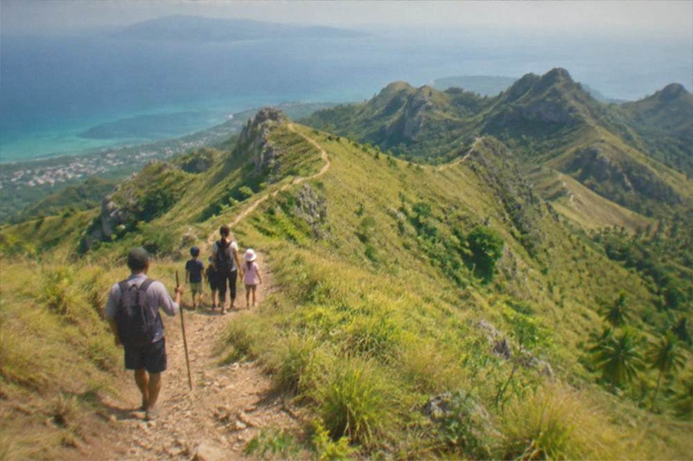
The verified pack does not publish a trail length, a summit altitude or a graded difficulty, and this guide will not invent them. What the pack does establish is the fee structure, the guide norm and the climate, and those three together describe a walk that families manage routinely: a small cash fee, a local guide who handles navigation, and a tropical climate where the morning is reliably the pleasant half of the day. Children who can handle a warm uphill path can handle this, and the guide fee is the same whether the group is two adults or a family of five.
The honest caveats are practical rather than dramatic. The drive from Cebu City is hours each way, which is a lot of vehicle time for young children, so families staying in Cebu City should weigh a booked tour with a comfortable van against two long bus legs. The dry season, December to May, is the family window, and March or April's 58.6 mm and 48.1 mm of monthly rain are the numbers to plan around. And the habal-habal ride up from the highway is a motorbike, full stop, which some parents will accept and others will not; the alternative is a tour vehicle that drives the same road.
For families building a wider trip, the Cebu with kids itinerary keeps the whole province in view, and the highlands pair well with gentler stops such as the Sirao Flower Garden at about P100 (about US$1.6) entry or the free Taoist Temple, both covered in their own guides.
What Tours From Cebu City Include Osmeña Peak?
The main booked option from Cebu City is a combo day tour that pairs Osmeña Peak with Kawasan Falls, running about 11 hours with pickup in the city, and its price, rating and review count render live on the live listing rather than on this page. Two other south-coast products, a 10-hour Kawasan Falls tour and a long private Kalanggaman and Malapascua island day, round out the roster for visitors who want the far south or the far north instead.
Tour figures on this site are never typed into prose. Each card below pulls its price, rating and duration from verified product data at render time, which is why this page can stay accurate when an operator changes a rate. What can be said in words is the shape of each day: the peak-plus-falls combo is the natural fit for this guide, the Kawasan-only tour suits visitors who want the canyoneering or swimming day without the ridge, and the Kalanggaman and Malapascua private trip is a different beast entirely, a long day aimed at travellers basing themselves in the north.
Choosing between them is mostly a question of where your nights are. A visitor based in Cebu City gets the most from the combo day, because the tour absorbs the drive that would otherwise eat the morning. A visitor already based down in Moalboal or Oslob may find the local options cheaper and shorter, though those products' own listings carry the figures. And anyone whose heart is set on the far north, on Malapascua's thresher sharks, should let the private Kalanggaman and Malapascua day below do the talking rather than trying to bolt the highlands onto a trip that is already pointed the other way up the island.
Whatever you book, two habits protect the day. Check the cancellation terms on the live listing before you pay, since most operators on this corridor offer free cancellation up to 24 hours out, and confirm the pickup window the night before, because south-coast tours leave early and wait for no one. The Cebu Travel Guide hub covers the rest of the island if the ridge leaves you wanting more.
Common Questions About Osmeña Peak In Cebu
How much does it cost to hike Osmeña Peak in Cebu?
Registration runs about P50 (about US$0.8) to P100 (about US$1.6) per person, and a local guide costs roughly P200 (about US$3.2) to P300 (about US$4.8). No official municipal price list is published, so treat those as planning ranges and bring small bills. The bigger cost of the day is transport from Cebu City, several hours by road each way.
Do you need a guide for Osmeña Peak?
A guide is strongly recommended and in practice often required, at roughly P200 (about US$3.2) to P300 (about US$4.8) paid locally. The fee is small relative to the rest of the day and the income stays in the local barangay, so budget for one regardless of how the requirement is enforced on the day you visit.
What is the best month to hike Osmeña Peak in Cebu?
The dry season, December to May, is the best window, with March and April the driest months at 58.6 mm and 48.1 mm of rain respectively on PAGASA's Mactan normals. October is the wettest month at 194.8 mm and the June-to-November rainy season brings typhoon risk, so avoid that stretch for a casual visit.
Can you visit Osmeña Peak and Kawasan Falls on the same day?
Yes. Both sit on the same southbound corridor from Cebu City, and booked combo tours from the city exist for exactly this day. Kawasan's Level 1 entrance is about P200 (about US$3.2) for swimming, and canyoneering with a Badian-accredited guide runs roughly P1,500 (about US$24) to P2,000 (about US$32) including gear and lunch. The Alegria canyoneering route is suspended, so only the Badian route operates.
How do you get to Osmeña Peak from Cebu City without a tour?
Take a southbound Ceres bus from the Cebu South Bus Terminal along the south coast, then a habal-habal motorbike up from the highway to the trailhead. The verified pack gives the Oslob route at about 3.5 to 4.5 hours and P145 (about US$2.3) to P250 (about US$4.0), and the Moalboal route at about 2.5 to 3.5 hours and P120 (about US$1.9) to P210 (about US$3.3); no Dalaguete-specific fare is published, so confirm at the terminal.
Is Osmeña Peak a hard hike?
The verified sources do not publish a trail length or difficulty grade, so no honest page should claim one. What they do establish is a small registration fee, a local guide norm and a tropical climate with a mean maximum of 31.3 C, which together describe a short, hot, exposed walk that beginners and families manage routinely with an early start and water.
The ridge above Dalaguete is the simplest argument for Cebu that there is: one island, one day, a mountain in the morning and a waterfall or a sardine run in the afternoon, all on a single road south from the city. Pick your month from the rainfall table, book the drive or brave the bus, and the highlands will do the rest.