Cebu Weather And Typhoon Season
Cebu sits in the Central Visayas region of the Philippines, and its weather runs on two seasons rather than four: a dry stretch from December to May and a rainy, typhoon-prone stretch from June to November. Here is what the official climate record says, when storms actually arrive, and how to plan around them.
Short answer
PAGASA classifies the Philippines as rainy from June to November and dry from December to May. Cebu's Mactan station records 1,685 mm of rain a year across 138 rain days, with a mean temperature of 28.1 C. Typhoon risk runs June to November, peaking roughly July to October, but Cebu sits outside the country's main typhoon belt and direct hits are uncommon.
Cebu, an island province in the Central Visayas region of the Philippines, has a tropical climate with two seasons, not four. The state weather service, PAGASA, draws the line cleanly: rainy season from June to November, dry season from December to May. The Mactan station's 1991-2020 climate normals put annual rainfall at 1,685.0 mm spread over 138 rain days, with a mean temperature of 28.1 C, a mean maximum of 31.3 C and a mean minimum of 24.9 C. That is the whole system. There is no Mediterranean summer, no temperate autumn, just a wet half and a dry half of the year, with typhoons as the wildcard inside the wet half.
This guide lays out what the verified climate record actually shows, when typhoons reach Cebu, what closes when one arrives, and how to build an itinerary that survives a bad-weather week. The monthly rainfall figures below come from PAGASA's own normals for the Mactan station, and the storm history comes from news reporting on the two events that shaped Cebu's recent weather memory: the September 2025 earthquake-adjacent recovery and Typhoon Tino in November 2025.
What Is The Weather Like In Cebu Through The Year?
Cebu has a tropical climate with a dry season from December to May and a rainy season from June to November, per PAGASA's national classification. The Mactan station's 1991-2020 normals record 1,685.0 mm of rain per year across 138 rain days, with mean temperatures around 28.1 C. The driest month is April at 48.1 mm of rain, and the wettest is October at 194.8 mm. There is no cold season; the coolest months are simply the less hot ones.
The dry season splits into two feels. December through February is the cooler, drier stretch, when mornings start around the mid-20s Celsius and rainfall stays modest. March through May is the hot dry stretch, when the mean maximum climbs toward the top of the annual range and rain becomes short, sharp afternoon bursts rather than all-day events. Most locals treat March and April as the year's most reliably dry window.
The rainy season is not a monsoon in the South Asian sense. It is a pattern of increased thunderstorm activity, higher humidity and the possibility of tropical cyclones passing through or near the Visayas. A rainy-season day in Cebu often still delivers hours of sunshine; the rain arrives in intense bands, dumps its water and moves on. The real difference between June and January is not the presence of rain but its frequency and the chance that a named storm is somewhere in the forecast.
Here is what PAGASA's Mactan station normals show, month by month:
| Month | Average rainfall (mm) | Season |
|---|---|---|
| January | 105.2 | Dry (cool) |
| February | 69.6 | Dry (cool) |
| March | 58.6 | Dry (hot) |
| April | 48.1 | Dry (hot) |
| May | 95.0 | Dry (hot) |
| June | 175.6 | Rainy |
| July | 192.9 | Rainy |
| August | 143.5 | Rainy |
| September | 179.6 | Rainy |
| October | 194.8 | Rainy |
| November | 161.9 | Rainy |
| December | 139.7 | Dry (cool) |
Two things stand out. April is the driest month on the record at 48.1 mm, and October is the wettest at 194.8 mm. The jump between May and June is the single clearest weather signal in the Cebu year: rainfall nearly doubles in one month, and it stays high through the autumn.
For planning purposes, the dry half of the year is when the sea is calmest, the ferry schedules run most reliably and the day trips to Oslob, Moalboal and Bantayan behave as advertised. The rainy half is when prices soften, crowds thin and the odds of a disrupted day rise. Neither half is a reason to cancel a trip; they are just different games. The rest of this guide is about playing the rainy half well.
When Is Typhoon Season In Cebu?
Typhoon season in the Philippines runs from June to November, with peak activity roughly July to October, and PAGASA flags high landfall risk for the Visayas in the November-December window. Cebu lies south of the country's main typhoon track, so direct hits are less frequent than in Luzon, but the province is not immune. Typhoon Tino, known internationally as Kalmaegi, struck Cebu in early November 2025 and caused severe flooding.
The Philippines sits in the world's most active tropical cyclone basin, and PAGASA assigns Filipino names to storms entering its area of responsibility. Not every storm reaches the Visayas. Luzon and the eastern seaboard absorb most landfalls, and Mindanao sits largely outside the belt. Cebu occupies a middle position: close enough to the track that a passing storm can dump enormous rain on the island, far enough that a direct eye passage is a rare event rather than an annual one.
The calendar matters more than the averages. A July storm is a real possibility; a February storm is close to unheard of. The November-December stretch deserves special attention, because PAGASA's own guidance puts Visayas landfall risk at its highest then, even as the rest of the country starts thinking about the dry season. Typhoon Tino was a textbook case: it formed at the end of October 2025, crossed the Visayas in the first week of November and delivered a record 428 mm of rain in 24 hours on Cebu.
| Period | Typhoon risk in Cebu | What it means for a trip |
|---|---|---|
| December to May | Very low | Dry season; storms rare, sea calm |
| June | Rising | First storms of the year possible; rain doubles vs May |
| July to October | Peak | Roughly 2-4 cyclones per month nationally; plan buffer days |
| November to December | High landfall risk for Visayas | Late-season storms; Tino hit Cebu in Nov 2025 |
The practical rule travelers actually use: if your trip falls between June and November, build one flexible day into the itinerary and watch PAGASA's bulletins in the week before you fly. If it falls between December and May, book with confidence and check the forecast the way you would for any beach destination.
How Bad Was Typhoon Tino For Cebu In November 2025?
Typhoon Tino, internationally named Kalmaegi, hit Cebu around 4-5 November 2025 and produced a record 428 mm of rain in 24 hours, causing the worst flash flooding officials could recall, a province-wide state of calamity and 253 deaths across the Philippines according to Rappler's year-end tally. The storm formed on 31 October, dissipated on 7 November and hit the Visayas with multiple landfalls.
The rainfall figure is the one that stunned local officials. Four hundred twenty-eight millimetres in a single day is more than a quarter of Cebu's entire annual average, delivered in one event. Reports described half of Cebu City submerged and families displaced across the province. Some central areas were described as hit harder than Typhoon Odette in 2021, which for Cebuanos is the reference storm of the century so far.
The tourism outcome, importantly, was narrower than the news footage suggested. The Department of Tourism stated on 11 November 2025 that Cebu's core zones, Cebu City and Mactan, were largely unaffected, safe and open, and appealed to tourists not to cancel flights. Around 1,400 tourism workers were temporarily impacted, and operations were described as largely normal within days. The storm was a catastrophe for flooded neighborhoods and a disruption, not a wipeout, for the visitor economy.
That distinction is worth internalizing, because it repeats with every major weather event in Cebu. The island's tourist infrastructure, concentrated in Cebu City, Mactan and the southern towns, recovers fast. The damage concentrates in low-lying residential areas and, in the case of the September 2025 earthquake, in northern heritage churches. A storm in the news is rarely a storm that ends your trip; it is a storm that rearranges two or three days of it.
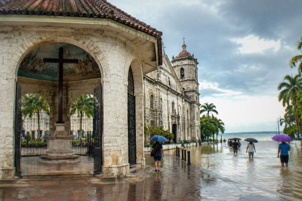
Tino also landed on a province already shaken. One month earlier, on 30 September 2025, a magnitude 6.9 earthquake off northern Cebu damaged coral-stone churches in Bogo, Daanbantayan, Bantayan and San Remigio. The two disasters together made late 2025 the roughest stretch in Cebu's recent memory, and both became the reference points for every "is Cebu safe" question that followed. The answer, per the DOT's October and November statements, was yes: the province was declared open for tourists, with Bantayan and Malapascua ports operational.
Rainy-season trips still reward planning, and the best wet-weather plans lean on activities that move indoors. A guided food walk through Cebu's markets is the classic backup: it runs in rain, it covers dinner, and it turns a washed-out afternoon into the day's highlight.
What Actually Closes In Cebu When A Typhoon Hits?
When a typhoon warning is raised, the predictable closures in Cebu are domestic ferries, small-boat island hopping, canyoneering at Kawasan Falls and whale shark interactions in Oslob, along with occasional school and office suspensions. Roads, malls, hotels and the airport generally stay operational unless flooding is severe. Closures are usually measured in hours to two days, not weeks, and the DOT repeatedly confirms the province reopens quickly.
The sea closes first. The Philippine Coast Guard suspends vessel movements when wind signals are raised, which stops the Cebu City to Tagbilaran fastcraft, the RORO services and every island-hopping bangka from Mactan. The OceanJet fastcraft to Bohol, running about 13 sailings a day at fares of P960 (about US$15.3) tourist class or P1,440 (about US$23) business class after the September 2026 fuel surcharge, is exactly the kind of service that pauses and then resumes on schedule. If your itinerary depends on a ferry, the storm signal is the thing to watch, not the rain itself.
Adventure activities close second. Canyoneering at Kawasan Falls suspends for rain and safety with some regularity; the record shows short shutdowns in June 2025, October and November 2025, and several points in 2026, plus a rockfall-triggered suspension in late October 2025 that lasted two days. The falls themselves often stay open to swimmers at Level 1 even while the canyoneering route is paused. The Alegria canyoneering route, meanwhile, has been suspended throughout 2025-2026, leaving Badian as the only operational route regardless of weather.
Whale shark watching in Oslob runs daily from about 6 AM to noon, and the whale sharks themselves are the variable. In late May 2026 the sharks were absent from the Tan-awan interaction area for roughly four days because seasonal plankton movement drew them toward a neighboring barangay; the town's operations paused with the sightings and resumed when the sharks did. Rain rarely stops the activity outright, but rough seas and sightings both matter.
| Activity or service | Typical typhoon-season disruption | Usual recovery |
|---|---|---|
| Fastcraft ferries (Cebu-Bohol) | Coast Guard suspension under wind signals | Same day to 1 day |
| Island hopping from Mactan | Small-boat operations pause | 1 day |
| Kawasan canyoneering | Rain and safety suspensions | 1-3 days |
| Oslob whale sharks | Sighting-dependent pauses | Days, with the sharks |
| Cebu City and Mactan hotels, malls | Rarely close | Immediate |
| Mactan-Cebu International Airport | Flight cancellations during the storm | 1-2 days |
What does not close is the city. Malls, restaurants, hotels and the SM Seaside complex stayed operational through Tino's aftermath, and the DOT's post-storm statements emphasized that the main tourism zones were open. The 25,000-seat SM Seaside Cebu Arena, which opened in July 2026, is the newest example of the indoor infrastructure a rainy day in Cebu can absorb. A typhoon day in Cebu City is a mall day, a museum day or a long lechon lunch, not a stranded day.

One closure pattern deserves a note for northern itineraries. The September 2025 earthquake, not a typhoon, put several northern heritage churches off-limits, including Bogo's Archdiocesan Shrine of San Vicente Ferrer, which was told to hold no indoor masses for six months to a year. If your route includes the old coral-stone churches of Daanbantayan, Bantayan or San Remigio, check current status separately from the weather; earthquake damage and storm closures follow different clocks.
Which Month Is The Best To Visit Cebu?
The best months to visit Cebu are March and April, the driest stretch of the year at 58.6 mm and 48.1 mm of monthly rainfall respectively, with calm seas and the lowest chance of typhoon disruption. January is the alternative pick if you want the Sinulog Festival, held on the third Sunday of the month, in exchange for slightly higher rainfall at 105.2 mm. December through May all qualify as safe-booking months.
March and April win on the numbers. They sit at the bottom of the rainfall table, the typhoon season is months away, and the sea state around Mactan, Olango and the Camotes Islands is at its most predictable. The trade-off is heat and crowds: this is the hot dry stretch, the mean maximum presses toward its annual peak, and it is high season for a reason.
January trades a little rain for the biggest event in the Cebu calendar. Sinulog's Grand Parade falls on the third Sunday of January, confirmed for 17 January 2027 with the Cebu City Sports Center as the main venue, after the festival returned to the CCSC from the South Road Properties site used in 2023-2024. Rainfall at 105.2 mm is still modest by rainy-season standards. Book early and expect the city to be full.
The June-to-November window is the value window. Rain is frequent but rarely all-day, hotel rates soften, and the sardine run at Moalboal does not care about the season: the school is resident year-round at the Panagsama reef wall, a short swim from shore, and the municipal tourism site confirms it as a daily attraction with best conditions in the 7-9 AM range. The environmental user fee to swim or snorkel there is P100 (about US$1.6) under the local ordinance.
| Month | Rainfall (mm) | Why go or not |
|---|---|---|
| January | 105.2 | Sinulog on the third Sunday; lively, busy |
| February | 69.6 | Dry, cooler, relaxed post-festival city |
| March | 58.6 | Excellent all-round conditions |
| April | 48.1 | Driest month; hot, high season |
| May | 95.0 | Hot; rain returns late in the month |
| June | 175.6 | Rainy season begins; rates drop |
| July | 192.9 | Peak typhoon months begin |
| August | 143.5 | Storm watch needed; quiet |
| September | 179.6 | Storm watch needed; quiet |
| October | 194.8 | Wettest month on the normals |
| November | 161.9 | Late-season storm risk; Tino hit in 2025 |
| December | 139.7 | Rain tapering; festive, busy |
The honest summary is that Cebu has roughly five near-guaranteed months and seven negotiable ones. If your dates are fixed inside the negotiable seven, the rest of this guide is your toolkit: buffer days, indoor backups and a habit of checking PAGASA rather than a generic weather app. If you want a deeper comparison of seasons, the best time to visit Cebu guide breaks it down further, and the Cebu itinerary pages show what fits in each length of stay.
How Do You Read PAGASA Advisories Before A Cebu Trip?
PAGASA, the Philippine Atmospheric, Geophysical and Astronomical Services Administration, is the authoritative source for Cebu weather, issuing tropical cyclone wind signals, rainfall warnings and gale warnings that directly trigger ferry and small-boat suspensions. Its bulletins are free, updated several times daily during active events, and name storms using a Filipino list, such as Tino for the 2025 storm known internationally as Kalmaegi.
The single most useful thing to know is the wind signal system. When PAGASA raises a tropical cyclone wind signal over Cebu or the surrounding seas, the Coast Guard acts on it, and that is what stops ferries and bangkas. Rainfall warnings, issued as yellow, orange and red levels, tell you about flooding risk in the city. Gale warnings cover sea conditions for divers and island hoppers. Three different bulletins, three different consequences, all from one agency.
Generic international weather apps underperform in the Philippines because they smooth PAGASA's data and often miss localized rainfall warnings. In the week before a rainy-season trip, the routine is simple: check PAGASA's current bulletin every second day, watch for any named storm east of the Philippines, and if one exists, track whether its forecast cone touches the Visayas. Storms there move fast; a typhoon three days out is a planning input, a typhoon twelve hours out is a rearrangement.
For day-to-day rainy-season decisions, the pattern that matters is the afternoon thunderstorm. Cebu's rainy-season rain concentrates in intense bands, frequently in the afternoon or overnight, and a morning boat trip followed by an indoor afternoon is the standard local rhythm. The whale shark interaction in Oslob runs in the morning for exactly this kind of reason, and its roughly 6 AM to noon window is the calmest part of the day on the water.
One warning about warnings: fake advisory screenshots circulate on social media during every storm. PAGASA's own channels are the only reliable source, and the Bureau of Immigration has repeatedly issued the same warning about fake eTravel sites charging fees for a free government service. The Philippines' official digital services are free, and anything charging for them deserves suspicion. The Philippines visa and eTravel guide covers the entry side of that system.
What Should You Pack For Cebu's Rainy Season?
For Cebu's rainy season, pack quick-dry clothing, a compact umbrella or light rain shell, reef-safe sun protection for the dry hours, and a dry bag for electronics on boat days, because the rain arrives in intense bursts between long sunny stretches rather than as all-day drizzle. Temperatures stay warm year-round, with a mean of 28.1 C and a mean minimum of 24.9 C, so cold-weather gear is never needed.
The packing mistake visitors make is treating the rainy season like a European winter. It is not. The mean minimum temperature of 24.9 C means the coldest Cebu night of the year is warmer than most northern summer evenings. What the rain demands is not insulation but water management: clothes that dry overnight, shoes that survive a flooded street, and a bag that keeps a passport dry when a bangka ride turns wet.
The sun protection item is the one people forget. Rainy season in Cebu still delivers hours of direct equatorial sun, and the UV does not negotiate with cloud cover. Reef-safe sunscreen matters for a specific reason at Oslob: the interaction rules ban sunscreen entirely in the whale shark area, so rash guards and cover-ups are the practical answer there. The Oslob whale sharks guide covers the full rule set, including the 4-meter minimum distance and the no-feeding provisions.
| Item | Why it earns its place |
|---|---|
| Compact umbrella | Afternoon bursts are the default rainy-season pattern |
| Quick-dry clothing | Laundry dries overnight even in humid months |
| Dry bag (10-20 L) | Boat trips and sudden squalls on island hopping days |
| Reef-safe sunscreen | Required for marine sanctuaries; banned at Oslob |
| Rash guard | Sun and stinger protection; replaces sunscreen at Oslob |
| Non-slip sandals | Wet marble, wet gangplanks, wet market floors |
| Light layer for malls and buses | Aggressive air conditioning is the only cold in Cebu |
Add one practical note on money and weather. Typhoon days push everything toward cash and toward indoor spending: markets, malls and food. The Cebu budget and costs guide gives the full picture of what a trip costs by season, and the rainy months are reliably the cheaper half of the year across hotels and tours.
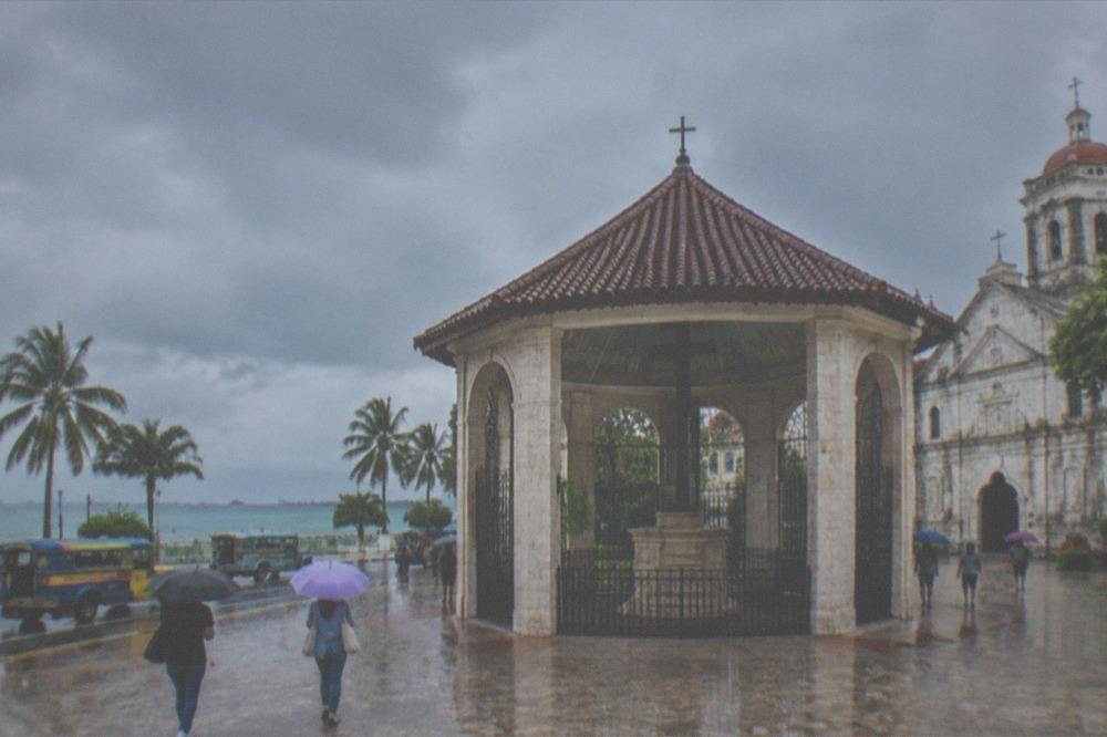
A food-focused walking tour is the highest-probability rainy-day winner in the city, and the market food walk is the one to hold in reserve for a washed-out afternoon.
Between the market walk and the mall network, a rain day in Cebu City rarely goes to waste. The Cebu food and lechon guide maps the dishes worth seeking regardless of weather, from the roast pig that made the city famous to the everyday market plates a guide will lead you to.
Does Rain Ruin The Beach And Diving Days In Cebu?
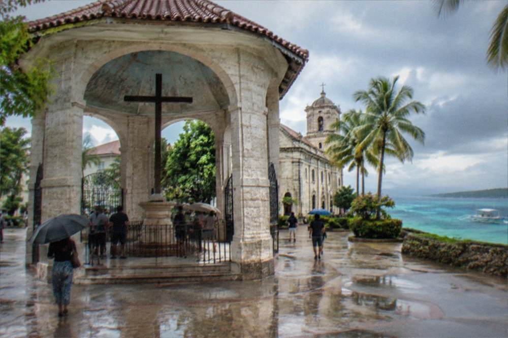
Rain rarely ruins Cebu's beach and diving days by itself, because sea state and visibility, not rainfall, decide whether boats run and dives are worth doing; wind signals and gale warnings are what stop island hopping, while rain mostly affects mountain activities like canyoneering and hiking. Diving around Mactan and Moalboal operates year-round, with visibility best in the dry months of December to May.
The distinction that matters is rain versus wind. A rainy morning with light wind still produces runnable boats and acceptable snorkeling at Gilutungan, Nalusuan or the Mactan sandbars. A windy morning with clear skies stops everything. This is why the Coast Guard's wind-signal suspensions, not the rainfall forecast, are the operative check for any boat-based day in the rainy season.
Diving follows its own logic. Moalboal's sardine run is shore-accessible, resident year-round and only visibility-dependent, with the best months running November through May. Pescador Island's marine sanctuary charges about P100 (about US$1.6) per dive toward conservation, and its mooring-buoy rules apply in any season. The Cebu diving guide covers the full dive map, including Malapascua's thresher sharks, which have shifted mostly to Kimud Shoal, a dive site reached by early-morning boat regardless of the season.
Mountain and canyon activities are the true weather casualties. Canyoneering at Kawasan cannot run safely in flood conditions, and the activity's suspension history is almost entirely rain-driven. The falls' Level 1 basin, at an entrance of about P200 (about US$3.2), often remains open to swimmers even when the canyon route above is closed. If canyoneering is the centerpiece of your trip, the dry season is when it runs without suspense, and a half-day package from Moalboal is the most popular way to do it.
For island hopping from Mactan, the environmental fee structure is worth knowing before you go: P100 (about US$1.6) for foreign tourists, cut to P20 (about US$0.3) for local tourists by a July 2025 amendment, with separate marine sanctuary fees of roughly P150 (about US$2.4) to P300 (about US$4.8) at Hilutungan and Nalusuan. None of these fees pause for weather, but the boats do, so a flexible booking and a morning departure remain the two best hedges in the rainy months.
How Should You Plan A Rainy-Season Itinerary For Cebu?
Plan a rainy-season Cebu itinerary with one buffer day per week, morning outdoor activities, indoor afternoons, and a pre-picked list of weather-proof backups including museums, malls and a market food walk, because rainy-season rain arrives in bursts and the disruption is usually measured in half-days rather than whole trips. Keep ferry-dependent legs, like Bohol day trips, on the flexible end of the schedule rather than the fixed end.
The structure that works is simple. Front-load the weather-dependent items: whale sharks, canyoneering, island hopping, Osmeña Peak. Put the ferry legs and the long boat days early in the trip, so a one-day Coast Guard suspension costs you a reshuffle rather than a cancellation. Hold the city days, museum days and food days at the back, where they absorb whatever weather arrives. The getting around Cebu guide explains the transport layer, including the Ceres buses south to Oslob and Moalboal that run in most weather.
Book refundable where the option exists, and treat the CBRT buses, running partial operations on the Il Corso to IT Park corridor since March 2026, as a weather-proof way to cross the city. The airport link holds up in rain too: MyBus runs between SM City Cebu and Mactan-Cebu International Airport at fares of P30 (about US$0.5) to P50 (about US$0.8), in air-conditioned buses that ignore the weather entirely. The Cebu airport guide covers the full arrival picture.
For a Bohol day trip, the ferry is the weather pivot. The OceanJet fastcraft covers the crossing in about two hours, and the Cebu to Bohol ferry guide details the schedule logic; a storm signal pauses sailings, while ordinary rain does not. The ferries from Cebu guide extends the same logic to Bantayan, Camotes and other island routes, each with its own exposure to the Coast Guard's wind rules.
The final piece of rainy-season planning is psychological. Cebu's wet half of the year is not a cancelled half. It is the half with softer prices, emptier whale shark mornings, resident sardines and a city that knows exactly what to do with a rainy afternoon. Travelers who arrive with a buffer day and a backup list consistently report the same thing: the storm on the forecast was a paragraph of the trip, not the story of it.
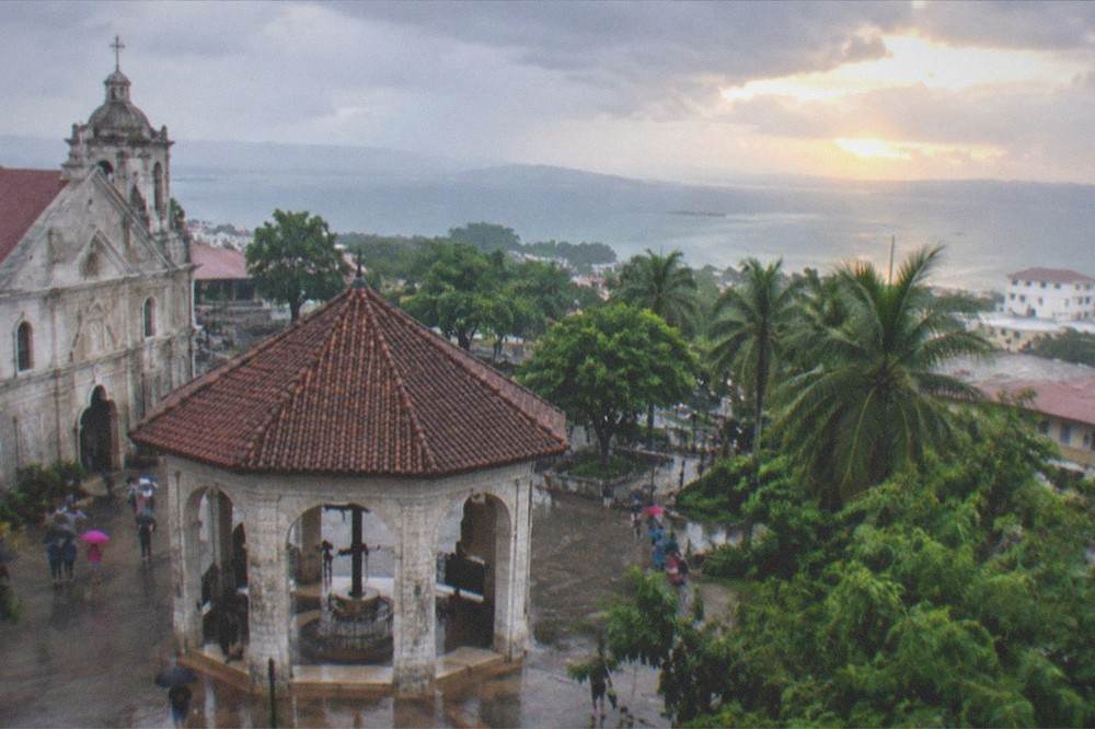
For everything that fits around the weather, the Cebu travel guide hub on Cebu Travel Guide indexes the full planning library, from itineraries to neighborhood guides, and the Cebu safety guide covers the advisory picture that weather events feed into.
Common Questions About Cebu Weather And Typhoon Season
What is the rainy season in Cebu?
PAGASA classifies the rainy season as June to November nationwide, and Cebu follows that pattern. The Mactan station's 1991-2020 normals show rainfall jumping from 95.0 mm in May to 175.6 mm in June and staying high through October, the wettest month at 194.8 mm. The dry season runs December to May.
Does Cebu get typhoons?
Yes, though less often than Luzon, because Cebu sits south of the Philippines' main typhoon track. Typhoon season runs June to November with peak activity roughly July to October, and PAGASA flags high Visayas landfall risk in November and December. Typhoon Tino struck Cebu in early November 2025, delivering a record 428 mm of rain in 24 hours and severe flooding.
What is the hottest month in Cebu?
The hot dry stretch runs March to May, with the Mactan station's mean maximum temperature at 31.3 C across the year. April, the driest month at 48.1 mm of rain, is typically the peak of the hot season. Temperatures stay warm year-round, with an annual mean of 28.1 C and a mean minimum of 24.9 C.
Is December a good time to visit Cebu?
Yes. December opens the dry season, with rainfall tapering to 139.7 mm on the monthly normals and dropping further into January and February. The trade-off is crowds and rates around the holidays, plus lively festivities. January adds Sinulog, held on the third Sunday of the month.
Do ferries stop when there is a typhoon near Cebu?
Yes, when PAGASA raises a wind signal over the relevant sea area, the Philippine Coast Guard suspends vessel movements, which stops fastcraft, RORO and small-boat services. Ordinary rain does not stop ferries. Suspensions typically last from hours to a day or two, and schedules resume quickly after the signal is lifted.
Is Cebu safe to visit during typhoon season?
Generally yes. Foreign advisories for the Philippines, including the UK's, carry no Cebu-specific restrictions, and the Department of Tourism declared the province open and safe after both the September 2025 earthquake and Typhoon Tino in November 2025. The practical precautions are a buffer day, morning outdoor plans and checking PAGASA rather than a generic app.